Chart Nautical - Imray - D10 9780852887127


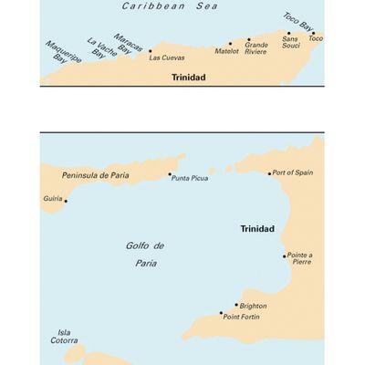
Nautical chart for leisure marine navigation covering sea area of North Coast Of Trinidad And Golfo De Paria

Chart Nautical - Imray - D10 9780852887127

Product Detail

item
Item type Chart nautical
identity
Primary identity code for a product or service 9780852887127
Product brand Imray
Product range Caribbean Series
Original title North Coast Of Trinidad And Golfo De Paria
sale
Quantity of items per container for retail sale 1 per-pack
Global Trade Item Number / International Article Number / European Article Number code of retail pack 9780852887127
facility
Sovereign country covered Trinidad N
marketing
Model code D10
information
Subject covered Navigation
information publish
Master document publication date 20030400
Media used for publication of this information; primary Paper
Information output media form; primary Sheet
cartography
Chart/map measurement system WGS 84
Chart or map area covered Trinidad N And Golfo De Paria 1:145000
location geographic
Sea covered Caribbean Sea SE
Golfo de Paria